The Sahara Was Not Always Sand
Look at a satellite image of North Africa today, and you'll see a massive, sun-baked expanse of yellow and orange sand. The Sahara covers roughly 3.6 million square miles, making it the largest hot desert on the planet.
It wasn't always this way. If you enjoyed this article, you might want to read: this related article.
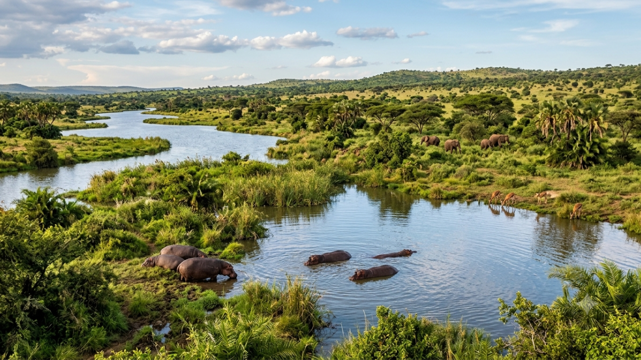
Just 6,000 to 11,000 years ago—a mere blip in geological time—this hyper-arid wasteland was a lush patchwork of rolling grasslands, savanna woodlands, sprawling river networks, and massive lakes. Hippos, crocodiles, giraffes, and elephants thrived where dunes now drift. Ancient human communities rowed canoes across Lake Megachad, an inland sea larger than all North American Great Lakes combined, and etched pictures of aquatic wildlife into mountain rock faces.
This wasn't a one-off anomaly. Geological records show North Africa flips between desert and a vibrant ecosystem every 20,000 years. For another perspective on this story, see the recent coverage from The Guardian.
Earth’s Wobble Drives the 20,000-Year Clockwork
Why does an ocean of sand transform into a green paradise on such a regular schedule? The answer lies in space.
Earth doesn't spin cleanly like a billiard ball; it wobbles like a slowing top. This wobble, known to scientists as axial precession, operates on a cycle lasting roughly 19,000 to 23,000 years. As the planet's rotational axis gradually shifts, it alters the distance between Earth and the Sun during specific seasons.
When axial precession lines up so that the Northern Hemisphere sits closest to the Sun during summer, Northern Africa gets hit with significantly more intense solar radiation.
That extra heat triggers a massive physical reaction:
- The North African landmass heats up much faster than the surrounding Atlantic Ocean.
- This extreme temperature gap creates a low-pressure zone over the land.
- The pressure drop pulls cool, moisture-laden air inland from the Atlantic Ocean.
- The North African Monsoon strengthens, driving rain deep into regions that normally don't see a drop.
       [ Intense Summer Solar Energy ]
                     │
                     ▼
  [ Land Heats Faster Than Atlantic Ocean ]
                     │
                     ▼
  [ Low-Pressure Zone Draws Ocean Air Inland ]
                     │
                     ▼
  [ West African Monsoon Pushed Northward ]
                     │
                     ▼
  [ Monsoon Rains Transform Desert to Savanna ]
Feedback Loops Do the Heavy Lifting
An extra burst of summer sunlight gets the monsoon moving, but orbital physics alone isn't strong enough to turn a desert green. Climate models that only look at sunlight fail to explain the massive rainfall totals found in geological samples.
Self-reinforcing feedback loops on Earth do most of the actual work.
Once monsoon rains creep northward, plants start growing. Bare sand reflects a huge amount of sunlight back into space, keeping the atmosphere dry. Dark green vegetation, on the other hand, absorbs sunlight, warming the surface further and drawing in even more monsoon moisture.
Plants hold moisture in the soil and release water vapor into the air through transpiration, creating their own localized rain cycles. At the same time, expanding grasslands trap dust that would otherwise float into the atmosphere and block cloud formation.
Once the greening reaches a critical tipping point, it powers itself.
| Environmental State | Surface Reflection (Albedo) | Atmospheric Dust | Monsoon Strength |
|---|---|---|---|
| Desert Phase | Very High (Reflects heat, suppresses rain) | High (Blocks cloud formation) | Weak & Suppressed |
| Green Sahara Phase | Low (Absorbs heat, fuels convection) | Minimal (Soil anchored by roots) | Strong & Deep-Penetrating |
How Scientists Proved an 11-Million-Year History
How do we know this 20,000-year beat has been ticking for millions of years? We looked at deep-ocean dirt.
For decades, oceanographers have drilled core samples from the North Atlantic seafloor off West Africa. These sediment layers act as a historical diary. During dry periods, strong winds carry Saharan dust far out to sea, leaving heavy layers of windblown dust on the ocean floor. During humid periods, ancient river networks—like the buried Tamanrasset River system mapped by satellite radar—washed organic mud and plant matter straight into the ocean.
A landmark study analyzing deep-sea cores traced these alternating wet-and-dry sediment layers back more than 11 million years. The pattern was clear: every 20,000 years, dust levels plummet and river sediments surge.
What the Green Sahara Actually Looked Like
When people hear "Green Sahara," they often picture dense tropical rainforests covering North Africa. That's a myth.
The region looked much more like the modern-day Serengeti or the Okavango Delta. It was a mosaic of environments:
- Open grasslands and shrublands carpeted flat terrain.
- Gallery forests lined river corridors.
- Massive wetlands filled low-lying geological basins.
It supported a rich ecosystem. Archaeological digs across Niger, Libya, and Algeria have uncovered thousands of bones from hippos, crocodiles, turtles, and Nile perch.
Ancient humans left behind vivid rock art in places like the Tadrart Acacus and Tassili n'Ajjer mountains. They painted scenes of people herding cattle, hunting giraffes, and paddling canoes. These aren't mythical drawings; they are eyewitness accounts of a lost world.
The Collapse Was Fast and Violent
Around 5,000 to 6,000 years ago, Earth's orbital wobble shifted summer insolation away from the Northern Hemisphere. As sunlight intensity dropped, the African monsoon weakened, and the process flipped into reverse.
As rainfall decreased, plants died. Without plant cover, the ground reflected more sunlight, weakening the monsoon even further.
Many climate records suggest the transition from a green landscape back to hyper-arid desert happened in just a few centuries. Lakes dried up, grasslands turned to dust, and herds vanished. Human populations retreated toward dependable water sources, settling around the Nile River valley—a movement that helped spur the rise of pharaonic Egyptian civilization.
When Will the Sahara Turn Green Again?
The 20,000-year orbital clock keeps ticking regardless of human activity. The Sahara will green again.
Mathematically, the next peak in Northern Hemisphere summer sunlight driven by axial precession is set to occur in roughly 10,000 to 12,000 years. Under normal natural cycles, North Africa would gradually shift back to a lush, river-fed landscape around that time.
However, human-driven greenhouse gas emissions have thrown a wrench into the planet's natural climate timing. Higher global temperatures alter oceanic air currents and atmospheric pressure belts, making short-term monsoon shifts harder to predict. While extra atmospheric warmth can hold more moisture and potentially push monsoon rains northward sooner, extreme heating could also disrupt the ocean currents needed to drive the cycle.
Actionable Steps for Further Exploration
If you want to dive deeper into paleoclimatology and Earth’s orbital history, here is how to track the research yourself:
- Explore Satellite Paleodrainage Maps: Search open-access databases like NASA's Earth Observatory or Nature Communications for radar imaging studies of buried North African river systems (such as the Tamanrasset River).
- Track Marine Sediment Core Data: Visit the International Ocean Discovery Program (IODP) site to review sediment core records from the West African margin, which track windblown dust levels over millions of years.
- Study Milankovitch Cycles: Read up on orbital forcing parameters—eccentricity, axial tilt, and precession—to see how orbital mechanics drive long-term ice ages and monsoon cycles across the planet.