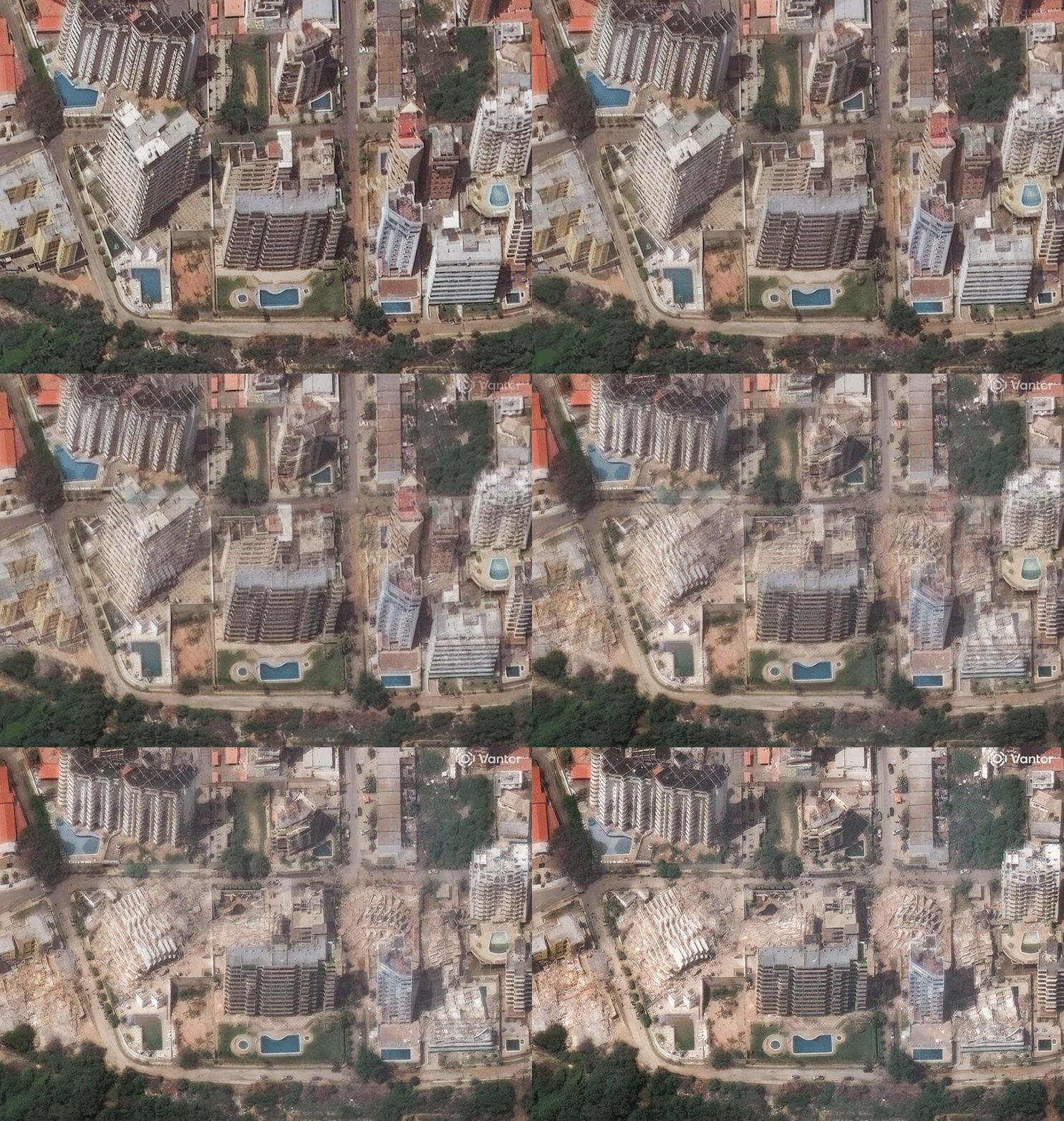
Initial media reports out of South America rarely capture the brutal reality of a tectonic disaster in real-time. When a pair of massive earthquakes tore through northern Venezuela on Wednesday evening, the first dispatches spoke of panicked crowds and cracked walls. The numbers trickling out were conservative. Then the orbiters passed overhead. High-resolution satellite images provided by spatial intelligence firm Vantor have completely shattered those early, sanitized narratives. What they show is a level of destruction that structural engineers and disaster response teams are still struggling to fully comprehend.
We aren't looking at typical tremor damage here. The before-and-after imagery reveals entire coastal blocks flattened, major transit hubs severed, and mountain slopes collapsed onto dense neighborhoods. The devastation in Venezuela after dual earthquakes isn't just a localized tragedy. It's a massive humanitarian catastrophe that has caught the nation completely unprepared.
The hard numbers are climbing rapidly. By Friday, official estimates tracked by regional monitors and international agencies pushed the confirmed death toll past 920 people. More than 3,300 are treated for severe injuries, and the number of people reported missing has surged past 51,000. The International Organization for Migration estimates that up to 6.76 million citizens live within the immediate impact zone. Two million of those are right in the capital city of Caracas.
The Brutal Mechanics of a Doublet Earthquake
Most people think of an earthquake as a single massive shock followed by smaller, tapering aftershocks. That didn't happen here. Venezuela was battered by a phenomenon known as a doublet earthquake. This happens when two distinct quakes of almost identical magnitude strike the exact same region in a tiny window of time.
The first hit at 6:00 PM local time. It registered as a powerful magnitude 7.2. As people rushed into the streets of Caracas and coastal La Guaira, the ground tore open again. Just 39 seconds later, a second, even larger magnitude 7.5 quake struck.
Think about what that does to a concrete structure. The first 7.2 shake fractures the foundations. It snaps the internal support pillars and cracks the load-bearing walls. The building loses its structural integrity but stays upright. Then, before anyone can comprehend what just happened, the 7.5 shock arrives. It hits a structure that's already compromised. The result isn't just damage. It's total structural failure.
Data from the US Geological Survey shows this nightmare originated along the Boconó fault system. This massive geological feature runs for about 300 miles along the spine of the Venezuelan Andes. It's the violent boundary where the Caribbean tectonic plate grinds eastward past the South American plate. They slide past each other horizontally at a rate of roughly 0.79 inches per year.
Christine Goulet from the USGS earthquake science center pointed out that this shallow strike-slip faulting mirrors the mechanics of California’s San Andreas fault. It creates an incredibly violent horizontal shearing motion. Northern Venezuela has seen this before, but rarely with this kind of back-to-back energy. A smaller doublet hit the west of Caracas in September 2025, but that was a minor warning compared to Wednesday's event. The last time the Boconó system slipped with this level of violence was centuries ago, including the infamous 1812 disaster that leveled Caracas.
What Satellite Data Shows About the Epicenter in La Guaira
The coastal state of La Guaira sits just ten miles north of Caracas, separated by a steep mountain range. It took the absolute brunt of the energy. Satellite photographs show that the neighborhood of Catia La Mar has been altered permanently.
On the screen, the change is stark. In the before images, you see orderly rows of multi-story apartment complexes and bustling commercial docks. In the after shots, those same coordinates look like gray smudges of pulverized concrete. Several high-rise residential buildings didn't just tip over. They pancaked straight down into their own footprints.
Satellites equipped with synthetic aperture radar can look through the thick clouds of smoke and dust rising from the rubble. This tech maps ground displacement down to the millimeter. The data shows that the coastline itself shifted horizontally during those 39 seconds. That abrupt earth movement instantly tore apart water mains, gas pipelines, and underground electrical grids.
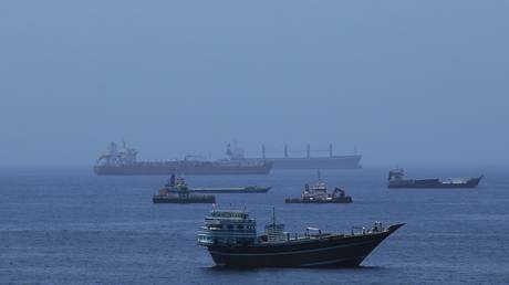
The port facilities in La Guaira are a complete mess. Container cranes have collapsed into the water. Major cracks run through the shipping piers. This completely blocks off the fastest route for maritime international aid to reach the center of the country. On top of that, the main highway connecting La Guaira to Caracas is blocked by massive landslides triggered by the twin shocks. Massive boulders and thousands of tons of loose mountain soil have buried the asphalt, isolating the coast from rescue teams based in the capital.
The Capital Under Siege
In Caracas, the damage is heavily concentrated in the northern and eastern districts. In the affluent neighborhood of Altamira, social media footage matched satellite confirmation showing multiple embassy-district buildings collapsed.
The city's vital transportation links failed instantly. Simon Bolivar International Airport suffered severe structural damage. The satellite view shows large sections of the terminal roof collapsed onto the passenger check-in areas. Debris covers the main runways, forcing authorities to close the facility to commercial and humanitarian flights alike. The metro and rail networks across the capital are completely dark, frozen by the instantaneous power grid failure that followed the second shock.
People are sleeping in public parks, squares, and open highways. They're terrified to go back inside any building that's still standing. They have a good reason to be scared. The USGS calculated a 99% probability of a magnitude 4 or higher aftershock rocking the region, and a 24% chance of another major magnitude 6 event. Without power, water, or functioning hospitals, the city is running on pure survival instinct.
Why the Lack of Early Warning Systems Cost Lives
Mexico and Japan have sophisticated sensor networks that give citizens precious seconds to evacuate before the shaking starts. Venezuela has nothing of the sort. The country relies on basic seismic monitoring that records disasters as they happen, rather than providing an active alert.
Building codes are another massive issue. A huge percentage of the population in Caracas and La Guaira lives in informal settlements called barrios. These homes are built out of unreinforced brick, corrugated iron, and weak cement, stacked precariously on steep hillsides. When the 7.2 quake hit, these hillsides started to slide. When the 7.5 hit, entire communities slid down the mountainsides.
Even the modern buildings constructed during the oil booms of the late 20th century weren't built to withstand a rapid doublet event. Engineers plan for a single major event followed by a cooling-off period. They don't design everyday civilian infrastructure to survive two maximum-intensity impacts within 40 seconds.
Actionable Steps for Direct Relief
The situation on the ground is changing by the hour, but the immediate needs are clear. If you want to support the emergency response, you need to look at organizations that have established ground footprints in South America and can bypass the broken ports.
- Support the International Federation of Red Cross and Red Crescent Societies (IFRC): They are working directly with the Venezuelan Red Cross on the ground. They are focusing on immediate search and rescue, field hospitals, and clean drinking water distribution.
- Direct Funds to Médecins Sans Frontières (Doctors Without Borders): With local hospitals collapsed or overwhelmed by thousands of trauma patients, MSF is setting up emergency triage tents in La Guaira and northern Caracas.
- Avoid Sending Physical Goods Independently: Broken highways and closed airports mean physical donation packages will get stuck in customs or sit at closed borders. Cash donations allow groups to buy supplies regionally and fly them in via military channels.
The next 72 hours are critical for the thousands of people trapped under the rubble in Catia La Mar and Altamira. As the satellite data continues to pour in, the true scale of this double disaster will only grow.