You probably think a super typhoon means flying umbrellas, shuttered windows, and torrential downpours. Usually, you would be right. But right now, Super Typhoon Bavi is playing a completely different game with Hong Kong. The massive storm is tracking far to our east, heading toward Taiwan and the eastern coast of mainland China. Yet, it is currently dictating every single breath we take in the city. Instead of cooling us down with rain, it has triggered an absolutely brutal heatwave that has turned the entire territory into a literal oven.
If you stepped outside today, you already know the air feels heavy, thick, and intensely hot. The Hong Kong Observatory has issued its extreme hot weather warning, and the numbers are climbing fast. We are looking at urban temperatures hitting 35 degrees Celsius, while parts of the New Territories are bracing for a staggering 37 or 38 degrees.
This is not your average summer discomfort. This is a severe meteorological phenomenon driven by a distant monster storm. To survive the weekend without getting heatstroke, you need to understand exactly what is happening to our atmosphere and how to handle it.
The Giant Atmospheric Hair Dryer Smothering the City
It sounds completely backward. How does a typhoon hundreds of kilometers away make a city hotter? The answer lies in a phenomenon called atmospheric subsidence.
Think of a super typhoon as a massive engine. At its center, columns of hot, wet air rush upward into the sky, creating violent storms and low pressure. But all that air has to go somewhere once it reaches the top. It spreads outward for hundreds of miles and then begins to sink back down to earth.
Hong Kong happens to be trapped right under this massive zone of sinking air. As the air descends from the high atmosphere, it compresses. Basic physics tells us that when you compress gas, it heats up. This descending air acts like a giant, invisible hair dryer pointed directly at the south China coast.
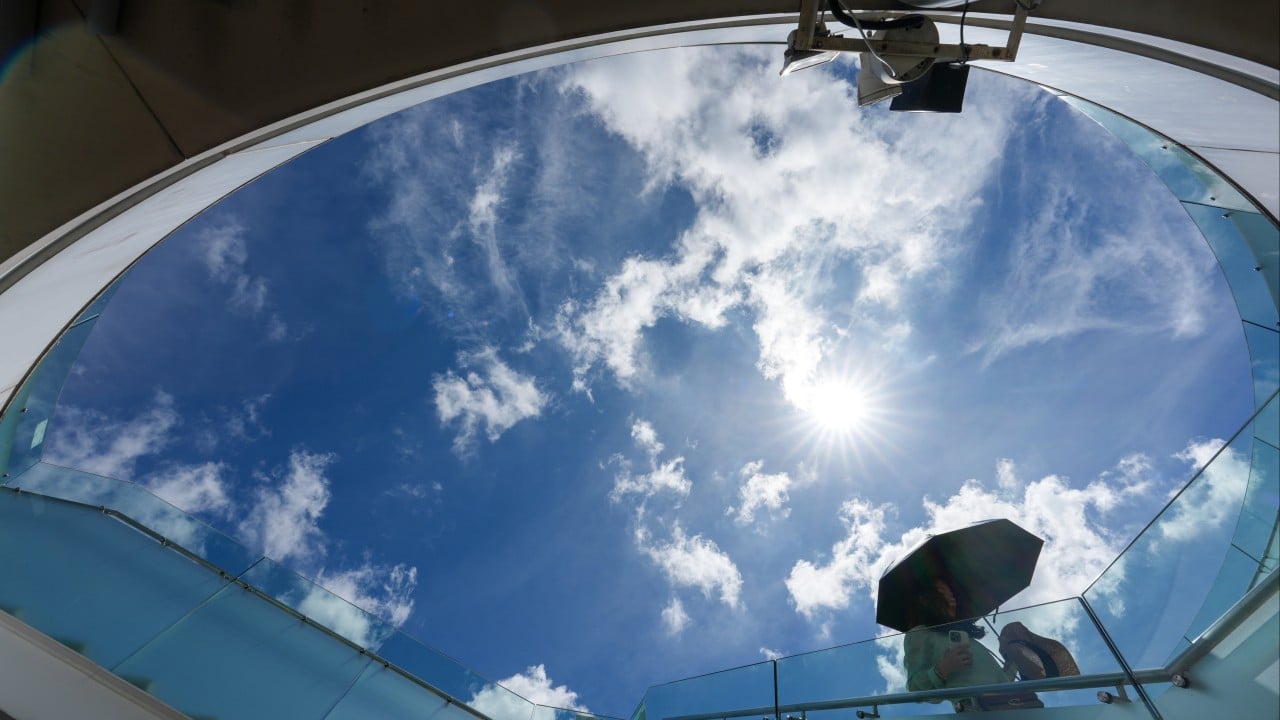
To make matters worse, this sinking air completely crushes any chance of cloud formation. Clouds need rising air to grow. With the air pushing down so forcefully, our skies stay clear, blue, and totally exposed to the fierce July sun. The solar radiation hits the concrete jungle of Hong Kong with zero filters, baking the buildings, roads, and sidewalks until they radiate heat back at us.
There is also a complete lack of wind. The typhoon is sucking all the regional air currents toward its own core, leaving Hong Kong in a stagnant pocket of dead, motionless air. Without a sea breeze to mix things up, the heat just sits here, accumulating hour after hour.
Breaking Down the Numbers Across the Districts
The headline numbers of 33 or 35 degrees do not tell the full story. Hong Kong is a land of microclimates, and where you live this weekend determines just how miserable you are going to be.
The urban core around Central, Tsim Sha Tsui, and Causeway Bay will easily see daytime maximums of 35 degrees. When you factor in the high humidity of midsummer, the real feel temperature will comfortably cross the 40-degree mark. Walking down Hennessy Road will feel like walking through a commercial kitchen.
The New Territories will bear the worst of the atmospheric baking. Inland areas do not have the immediate cooling benefit of the ocean. The Hong Kong Observatory projects that places like Ta Kwu Ling, Sai Kung, and Tin Shui Wai will hit at least 37 degrees.
If you live in Sheung Shui or Yuen Long, prepare for an absolute scorcher. Temperatures there are predicted to top out at 38 degrees Celsius. These are near-record levels of heat for the territory. At 38 degrees, the human body struggles immensely to cool itself down through sweating alone, especially when the relative humidity remains high.
The Dangerous Trap of Endless Hot Nights
Most people assume that once the sun goes down, the danger passes. That is a mistake. In fact, the nighttime weather right now is arguably more hazardous to public health than the blazing daytime sun.
Hong Kong is currently locked into a streak of what meteorologists call hot nights. By definition, a hot night occurs when the minimum temperature never drops below 28 degrees Celsius. We have already logged five consecutive hot nights this week, and we are on track to break monthly records.
Our urban environment makes this problem significantly worse. The concrete, steel, and asphalt of our skyscrapers absorb immense amounts of heat during the day. At night, they slowly release that stored energy back into the surrounding air. Walk past a concrete wall at midnight in Mong Kok, and you can literally feel the heat radiating off it.
When the nighttime temperature stays at 28 or 29 degrees, your body never gets a chance to recover. Your heart rate remains elevated as your system works overtime to pump blood to your skin to release heat. This continuous strain triggers deep physical fatigue. For the elderly, those living in subdivided flats without proper air conditioning, or people with pre-existing heart conditions, these sleepless, sweltering nights are incredibly dangerous.
The Sudden Whiplash of Seven Days of Rain
Enjoy the clear skies while you can, because this extreme heat is the calm before a very wet storm. The atmosphere cannot sustain this level of intense heat and energy forever.
By late Saturday, the extreme daytime temperatures will likely trigger localized, violent thunderstorms. As the ground bakes, small pockets of air will manage to burst through the sinking air layer, creating sudden downpours, intense lightning, and gusty winds. If you are planning outdoor activities on Saturday afternoon, do not let the blue skies fool you. Keep an eye on the weather radar.
Once we hit Sunday, the entire regional weather pattern turns completely upside down. As Typhoon Bavi moves further north and makes landfall on the mainland, it will drag a fresh, powerful southwest monsoon right behind it. This monsoon, combined with a broad trough of low pressure, will replace our giant hair dryer with a conveyor belt of tropical moisture.
The forecast indicates seven consecutive days of rain starting Sunday. We will go from extreme heat warnings straight into a week of gloomy, gray, and highly unstable weather filled with frequent showers and active thunderstorms. The maximum temperature will drop back down to a more typical 33 degrees, but the air will remain incredibly humid and sticky.
How to Navigate This Extreme Weekend Safely
This is not a weekend for heroic outdoor workouts or casual hiking expeditions up Lantau Peak or Tai Mo Shan. People underestimate heat until they are dizzy and vomiting on a trail waiting for a rescue helicopter.
Adjust your schedule immediately. If you must exercise outside, do it before 7 am or after 7 pm. Even then, dial back the intensity. Your body is working twice as hard just to keep your core temperature stable.
Hydration needs to be deliberate. Do not wait until you feel thirsty to drink water. By that time, you are already mildly dehydrated. Sip water consistently throughout the day. Throw in an electrolyte drink if you are sweating heavily, because you lose vital salts that plain water cannot replace. Avoid excessive alcohol or caffeine this weekend, as both push water out of your system faster.
Check on your neighbors and elderly relatives. Many older citizens hesitate to turn on their air conditioning because they worry about high electricity bills. Programs like the Beat the Heat project have been working hard to support vulnerable residents in dense areas like Yau Tsim Mong and Kwun Tong, but community awareness is vital. Make sure the vulnerable people in your life have working fans, cross-ventilation, or the financial reassurance to run their cooling units.
If you do feel symptoms like a throbbing headache, dizziness, nausea, or a rapid pulse, get out of the sun immediately. Find an air-conditioned mall, convenience store, or public library. Splash cool water on your face and neck.
Take this heatwave seriously. Stay indoors during the peak afternoon hours, keep your blinds drawn to block out the intense solar radiation, and prepare your umbrellas for the massive rain shift coming on Sunday.