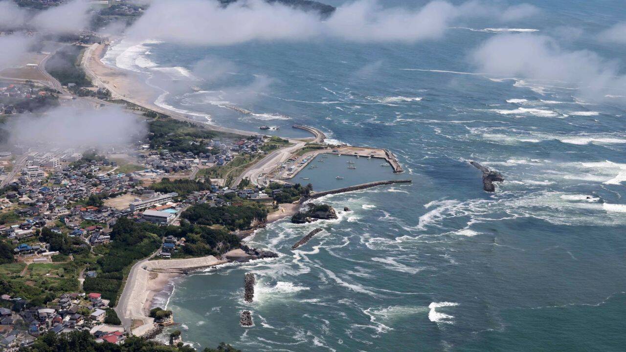
When a massive magnitude 8.8 earthquake ripped through the Kuril-Kamchatka subduction zone on July 29, 2025, it didn't just rattle eastern Russia. It sent a shockwave across the entire Pacific basin. For decades, textbook science told us that these deep-ocean killers behave in a predictable, orderly fashion. They're supposed to travel as single, clean blocks of energy without scattering much.
Except they don't. If you enjoyed this article, you should check out: this related article.
By absolute cosmic luck, an advanced satellite built by NASA and the French space agency (CNES) happened to pass directly over the unfolding disaster exactly 70 minutes after the rupture. What it saw fundamentally shattered long-held assumptions in geophysics. Instead of a uniform wall of water racing across the open ocean, the data exposed a chaotic, messy, and braided maze of waves interacting with the seafloor.
If you think tsunami science is already perfected, this single event proved how blind we've been to the real dangers heading toward our coastlines. For another look on this development, check out the latest update from NASA.
The Blind Spot in Traditional Tsunami Monitoring
To understand why this satellite pass matters so much, you have to look at how we normally track these events. For generations, oceanographers relied almost entirely on two things: coastal tide gauges and deep-ocean buoys.
The gold standard has been the DART network—which stands for Deep-ocean Assessment and Reporting of Tsunamis. These are pressure sensors anchored to the lonely floor of the Pacific Ocean. When a tsunami rolls overhead, the weight of the extra water increases the pressure on the seabed, and the buoy whistles an alert to a satellite.
It sounds foolproof. It isn't.
DART buoys are isolated dots in a mind-bogglingly vast ocean. They tell you exactly what is happening at one specific latitude and longitude, but they tell you absolutely nothing about the space between them. Trying to map a massive Pacific-wide wavefield using a handful of buoys is like trying to understand the brushstrokes of a massive museum painting by looking through a handful of drinking straws.
Satellites have crossed over tsunamis before, but older instruments could only measure sea levels along a razor-thin, single line. If the satellite track missed the main crest of the wave, the data was practically useless. This historic gap in space-based tracking left scientists guessing about the internal anatomy of an active wavefield.
How the SWOT Satellite Caught the Action
Enter the Surface Water and Ocean Topography satellite, or SWOT. Launched in late 2022, SWOT was never intended to be an early-warning disaster alert system. Its day job was mapping Earth's lakes, wide rivers, and subtle changes in ocean currents.
The magic lies in its wide-swath radar altimetry. Instead of tracing a single thin line, SWOT sweeps across a broad strip of the ocean surface roughly 75 miles wide with centimeter-level precision.
When the seabed off Kamchatka buckled, a research team led by physical oceanographer Angel Ruiz-Angulo from the University of Iceland was busy analyzing two years of SWOT data to track small ocean eddies. Suddenly, their routine data stream showed an anomaly east of Japan.
It was the leading edge of the mega tsunami, moving at the speed of a commercial jetliner. The satellite recorded a broad open-ocean crest rising about 1.5 feet above normal sea level. That might sound like a tiny bump when you're out in the deep blue, but out there, a 1.5-foot bulge contains a terrifying volume of displaced water. Once that energy slams into shallow coastal shelves, it bunches up and turns into a catastrophic wall of water.
The satellite data didn't just show a simple, neat hump. It captured a complex pattern of major ridges followed immediately by an entire train of shorter, jagged waves trailing behind the main front.
Dismantling the Myth of the Uniform Wave
This brings us to the biggest scientific shocker of the whole event. For a long time, standard operational models used by warning centers assumed that large, ocean-crossing tsunamis are non-dispersive.
In plain terms, a non-dispersive wave means that all components of the wave travel at the exact same speed, allowing the wave packet to hold its neat, terrifying shape over thousands of miles. It makes the math easy. It makes the computer simulations run fast.
The data from SWOT proved that this assumption is fundamentally wrong for massive subduction zone events.
The Kamchatka tsunami broke the rules. Because of a phenomenon called wave dispersion, different parts of the wave train traveled at slightly different speeds based on their specific wavelengths. The primary crest was constantly shifting, stretching out, and separating into a complex series of trailing waves. As these waves moved across the uneven topography of the Pacific ocean floor, they scattered and bounced around in ways traditional emergency models completely failed to predict.
When the research team plugged traditional non-dispersive physics into their computers, the simulations didn't match what the satellite actually saw in the open ocean. Only when they forced the models to account for complex wave dispersion did the computer simulation finally align with reality.
This means our current coastal hazard models are missing a massive piece of the puzzle. Trailing waves can merge, amplify, or alter the timing of when a tsunami hits land, changing a mild swell into a devastating local disaster.
Working Backward to Reconstruct a Megaquake
The satellite data didn't just expose secrets about the water. It also acted as a giant, cosmic mirror reflecting the exact shape of the earthquake that caused it.
When the magnitude 8.8 quake struck, initial seismic instruments on land estimated that the fault line ripped open along a 186-mile stretch of the ocean floor. But as the tsunami rippled outward, the real-world measurements from two separate DART buoys began throwing scientists for a loop. One buoy recorded the tsunami hitting much earlier than predicted, while another buoy further away registered the wave much later than expected.
The numbers simply didn't add up. The initial earthquake models were wrong.
To fix this, scientists from San Diego State University and the Scripps Institution of Oceanography used an advanced math technique called an inversion. They took the highly detailed, two-dimensional wave patterns captured by the SWOT satellite and effectively ran the physics backward to figure out what kind of seafloor movement could create that exact shape.
The results were eye-opening. The tectonic rupture didn't stop at 186 miles. It actually ripped open across nearly 250 miles of the Kuril-Kamchatka subduction zone.
Even more concerning, the satellite data showed that the fault slipped massively within just six miles of the shallow ocean trench. Land-based seismometers are notoriously terrible at detecting shallow slips far out at sea. The satellite filled this critical blind spot, showing a peak seafloor vertical uplift of roughly 13 feet right at the edge of the plate boundary.
Tracking Waves Through the Sky
The SWOT satellite wasn't the only eye in the sky rewriting the playbook during this event. NASA also deployed an experimental technology called GUARDIAN, which monitors tsunamis without even looking at the water.
Instead of measuring the ocean surface, GUARDIAN looks up into the ionosphere—the ionized layer of Earth's upper atmosphere.
When a massive slab of ocean floor jumps up during an earthquake, it doesn't just push the ocean. It creates an invisible, massive column of energy that ripples through the air. This acoustic wave expands upward until it hits the ionosphere, causing real-time distortions in the plasma layer.
By tapping into standard global navigation satellite signals like GPS, the GUARDIAN system tracked these upper-atmosphere distortions within 20 minutes of the Kamchatka quake. The tech actually confirmed clear tsunami signatures heading toward Hawaii and other islands a full 30 to 40 minutes before the physical waves ever reached the coastlines.
Combining wide-swath sea surface radar with upper-atmosphere plasma tracking gives us a glimpse into a future where we no longer have to wait for slow ocean sensors to confirm a threat.
Practical Safeguards for Coastal Communities
The messy reality of wave dispersion means you cannot count on a tsunami behaving like a textbook drawing. If you live in or manage a coastal zone, you need to rethink your safety strategies based on these new scientific realities.
- Expect multiple waves over hours: The discovery of prominent trailing wave trains proves that the first wave is rarely the biggest or the last. Dispersive waves can bunch up hours into the event, creating delayed surges that catch evacuees off guard.
- Ditch reliance on single-sensor confirmations: Local emergency managers shouldn't delay evacuation orders while waiting for a single deep-ocean buoy to register a hit. If a local subduction zone clears an 8.0 magnitude threshold, immediate movement to high ground is the only safe option.
- Update localized inundation maps: Current evacuation zones are often built on old, simplified wave models. Engineering firms and city planners must integrate dispersive wave physics into their flood models to ensure emergency shelters are actually built outside the true line of danger.
The ocean waves of the real world are far more volatile than the tidy formulas we've used for decades. The 2025 Kamchatka event proved that our technology is finally getting sharp enough to see the hidden mechanics of ocean disasters. Now, the emergency systems on the ground have to evolve just as fast.